Are there any mysteries left in this world? Has science advanced so far that there is little left to be learned, discovered, or uncovered?
There is a mystery in the landscape of South Texas – and like the Loch Ness monster and Sasquatch, we see only bits and pieces of evidence here and there. Like unusually large footprint or a fuzzy photo. It is an elusive idea, sometimes proven wrong, but then spotted again.
This mystery jeers at geologists, especially when we are near the shoreline as we study the coastal geomorphology, or the details of the landscape immediately along our coast.
Randy Bissell, Geologist
Was the sea level 1 to 2 m (3-6 ft.) higher 5000 years ago than today?
If true, that would break a lot of preconceptions about sea-level rise in the last 15,000 years (since the maximum of the Wisconsin Ice Age). If true, it would impact the certainty of a responsive or predictable relationship between CO2 and the modern sea level. If true, then in the recorded history of mankind, oscillations in sea level are regular – perhaps historically documented. If true, then the present-day rise in sea level might be a return to a “normal.”
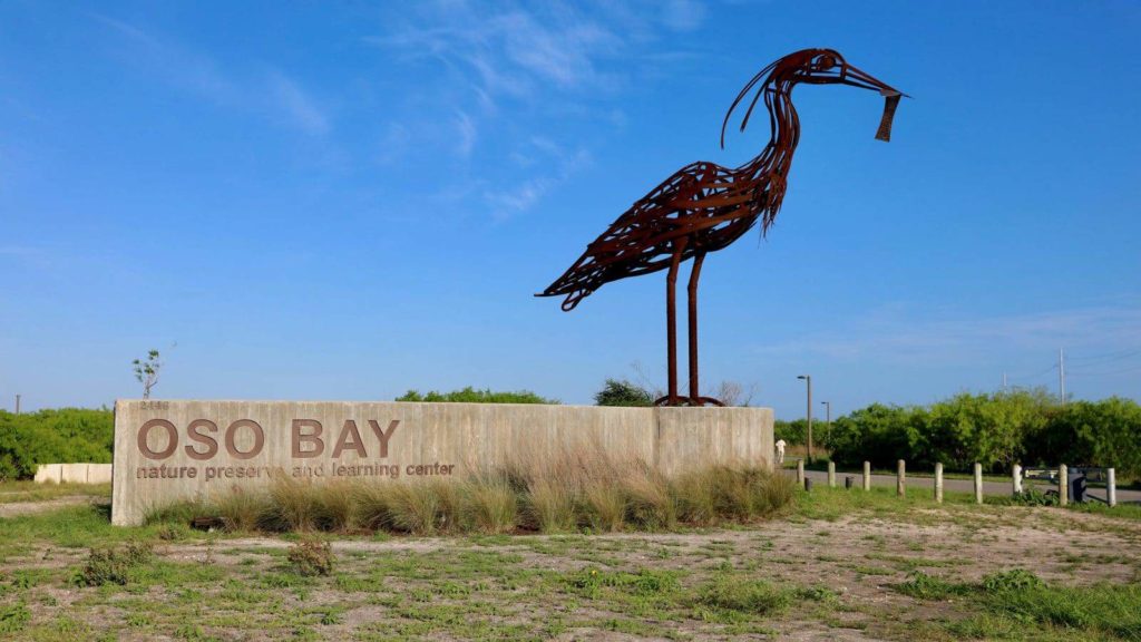
This sea-level mystery, our South Texas Bigfoot, might even be spotted at Oso Bay Wetlands Preserve!
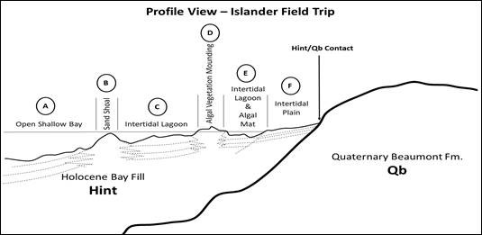
The Oso Bay Wetlands Preserve is beautifully at the shoreline. Geologically, the Preserve is made up of three basic components – the Beaumont Uplands, the “Wisconsin” Unconformity, and the Holocene Bay Fill.
The Beaumont Uplands are comprised of the ~125,000-year-old Beaumont Formation clays, commonly containing oyster shells. The soil type is a vertisol that hosts a variety of native trees, brush, and thorny thicket. Prairie grasses and cacti grow well on slopes here. A host of songbirds inhabit and nest in the dense foliage.

The Wisconsin Unconformity is not a unit, but rather a surface. It is the gentle erosional face or slope that fronts the Cayo de Oso estuarine bay. It is the erosional scar of a dramatic sea-level fall that occurred in the last 120,000 years to about 18,000 years ago as the Wisconsin Continental Glacier grew and advanced across much of North America. Global sea level fell 300 ft. Imagine looking into a deep ravine, perhaps 60-80 ft. deep separating the Preserve from a linear sandy hill, the present-day Flour Bluff.
Sea-level rising in the last 15,000 years has resulted in the Holocene Bay Fill, or the flat sandy and salty wetlands of the intertidal environment. The fine sands and silty entisols and aridisols onlap the Wisconsin Unconformity. The present-day sea level fills the estuary. Placing your finger at the contact between the Beaumont Formation (Qb) and the Holocene intertidal fill (Hint) represents a time gap of over 100,000 years. Here are the salt-tolerant worts, grasses, and mangroves. Ducks, roseate spoonbills, terns, gulls, and herons all love the natural productivity and diversity of food sources in these wetlands.
So, what if, 5000 years ago, sea level was a few feet higher than today, ebbed downward and then back upwards?
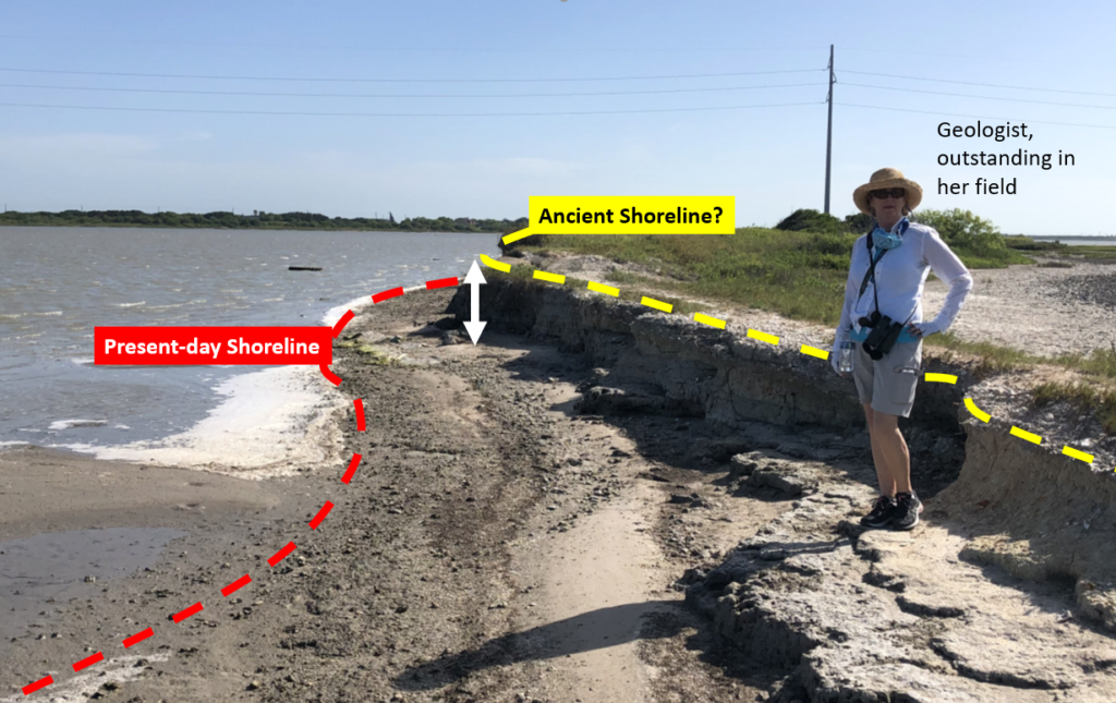
That history was first suggested in the 1970s and most recently published in the late 1990s. IF that happened, we might expect to find parts and pieces of ancient shorelines a few feet above the present coast…and maybe an unexplained shoreline terrace (or step) suggesting an ancient shoreline. There are some of those features at Oso Bay Wetlands Preserve – and they have also been seen along the coast all the way up to Aransas National Wildlife Refuge, which is similar geomorphologically.

Sea level ebbing above present-day about 3000 to 5000 years ago would explain other aspects of the South Texas Coastal landscape. For example, that is the time that our extensive barrier island systems begin development. Internally, Padre and Mustang Islands appear to be building seaward (prograding) until the present-day. That would seem to suggest sea level ebbing downwards until the present. Also, the Nueces River mouth and delta was once located near Labonte Park at I-37 between 7000 and 3000 years ago. Today it dumps into Nueces Bay near the refineries. If not a lowering sea level, why did it advance seaward during a sea-level rise?
Maybe my Bigfoot IS at the Oso Bay Wetlands Preserve. As you explore the park, keep your eyes peeled for unusual sights – and beautiful landscapes, plants, and animals.
Five Things to Notice at Oso Bay Wetlands Preserve
- As you arrive at the parking lot for the Preserve, you will walk eastward through the facilities towards the Oso. This is the Beaumont Upland. What types of native plants do you find? What birds do you encounter?
- Arriving at a point of overlook, you see the water of the Oso in front of you and across the bay there is Flour Bluff. To your left, there is an inlet of a tributary that is an incredible habitat for shorebirds. Now imagine removing ALL the water from the Oso. You would also remove the sandy bottom to reveal Beaumont Clay in the bottom of a ravine 75 ft. below your position on the overlook.
- Take the path northward across the swale of the tributary. As you walk to lower elevations, you are walking on the Wisconsinan Unconformity. What changes in plants do you notice? Where does salinity begin to make a difference in the plant diversity?
- A railroad used to parallel Holly Road and the trestle to Flour Bluff can still be seen crossing the Oso. A paved trail takes you out there. There is a path along the edge of the Oso where you can observe the two levels of shoreline, ancient and modern, like the photo above. What other changes in the environment or history (thinking humans, too) might cause this landscape?
- As you hike back to your vehicle, are there other features that stand out seeming unusual or misplaced? The stand of mimosa trees? The little hill in the tributary ravine? Is there a story you can tell?
Randy Bissell
Texas Master Naturalist & Texas Professional Geoscientist
July 26, 2020


