Discover Our State Parks
Our chapter leads interpretative hikes each spring and fall in all three state parks in Bastrop and Caldwell counties: Buescher State Park, Bastrop State Park and Lockhart State Park. These hikes are offered for the benefit of park patrons and supplement the regularly scheduled interpretative programs at each location. In the springtime, these guided hikes run from early March through early June. In the fall, they start in early October and run through mid-December. All hikes start at 10 a.m. and they are a wonderful way to get introduced to the unique landscapes of each of our parks. Each location has its own meeting place, so the best advice is to inquire at the respective headquarters building for directions.
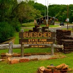
Buescher State Park
 Significantly enhanced in the 1930s by the Civilian Conservation Corps, the 1,017 acre park originally started as the Smithville City Park. One of the least known attractions of the park is Park Road 1C, a 12-mile stretch of narrow but beautiful road that connects to Bastrop State Park and is sure to delight every lover of nature. Buescher State Park has a self-contained 15-acre lake that is stocked with largemouth bass, sunfish and catfish. You can fish for rainbow trout in the winter months. Kayak and canoe rentals are available for a nominal fee. There is an extended system of trails at Buescher, both new and old, that wind through miles of loblolly pines, post and black jack oaks and eastern red cedars. The trail system is open to mountain biking. Wildlife native to the park includes many insects, reptiles, amphibians and mammals: white-tailed deer, raccoons, opossums, bobcats and armadillos. Cottontail rabbits, squirrels and small rodents also abound. Buescher is also prime habitat for the endangered Houston toad. While still considered part of the Lost Pines area, Buescher State Park is located within the greater ecosystem known as the Post Oak Savannah. Buescher State Park was spared from Bastrop County Complex wildfires; however, approximately two-thirds of the park was burned by the Hidden Pines wildfire of 2015.
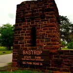
Bastrop State Park
 6,600 acres make Bastrop State Park the largest of the three. The Bastrop County Complex Fires of 2011 decimated the park. This wildfire was the most severe kind, not typically seen but every 500-1,000 years! Over 1.5 million loblolly pines were killed in that fire, with 96 percent of the park affected. Fortunately, most of the Civilian Conservation Corps structures, which gained the park national historic landmark status in 1997, were saved. The park was the heart of the Lost Pines ecotone and one of the last major refuges of the endangered Houston toad. A vigorous reforestation program has been underway since virtually months after the fire. Two million loblolly pine seedlings are set to be planted over time, native grasses and erosion control measures have been reintroduced, and a regimen of planned periodic prescribed burns has been instituted to reduce and manage heavy fuel loads in the park to lower the likelihood of another such destructive fire. Today, the park remains a popular destination for campers, hikers and tourists because the trail system is intact and extensive. Wildlife native to the park is slowly returning to what it was before the fire. Bastrop State Park is somewhat on display as a test of man’s ability to manage successional issues to ensure that a pine forest, once again, becomes the climax condition—to prevent the fabled Lost Pines from becoming truly lost. Wildflower hikes have recently been reintroduced at Bastrop State Park. These hikes run two hours, cover terrain ordinarily off-limits to the public, and are theme specific (wildflowers), therefore, are typically only done in the spring months.
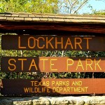
Lockhart State Park
 This park, although the smallest of the three at around 264 acres, is one of the best kept secrets in the state park system. Lush and green, it sports a variety of wildlife, birds and plant species. It is located within the Blackland Prairie ecoregion and is just a few short miles from the historic Chisolm Trail that once was one of the busiest cattle transport corridors in Texas. The Battle of Plum Creek, a collision of 600 Comanche and Kiowa warriors with early settlers, led in part by Ed Burleson and Mathew Caldwell, came to a bloody conclusion just outside the park’s front gate. Although built by the Civilian Conservation Corps in 1938, the park was originally used as a country club and did not open to the public until 1948. You can still find remnants of the foundations of old CCC barracks buildings across the road from the entrance gate. The 9-hole golf course and swimming pool are big draws through the warm months and the park has a running creek, miles of well-maintained trails and attractive camping sites. Crowds are comparatively small here, making Lockhart State Park a beautiful, quiet weekend refuge with plenty of ranger and master naturalist led activities to hold everyone’s interest.
Natural Areas in (and near) Bastrop & Caldwell Counties
 Colorado River Refuge
The Colorado River Refuge is a ribbon of riparian habitat along 1.5 miles of the Colorado River in Bastrop. The majestic old growth forest along the river is home to numerous birds, including bald eagle, osprey, great blue heron, wood duck, black-bellied tree duck, American kestrel, numerous hawks, and crested caracara. Serene views of the river and geological rock outcroppings are found along this section of the Colorado River. The area remains undeveloped, however, an existing trail along the river offers opportunities for hiking, fishing, birding and environmental study. This section of the Colorado River is also a popular destination for canoeing and kayaking. The Colorado River Refuge is a project of the Pines and Prairies Land Trust. Click here for maps of the trails along the Colorado River in Bastrop.
McKinney Roughs
McKinney Roughs is an 1,100 acre nature preserve located 8.4 miles west of Bastrop (13 miles east of Austin). McKinney Roughs has a varied topography, which creates a variety of ecological niches, including the westernmost extent of the “Lost Pines.” Steep rolling canyons give way to sandy bottomlands. Loblolly pines grow alongside fields of cacti and colorful wildflowers. The land is host to hundreds of species of mammals, birds, amphibians and reptiles and more than 135 varieties of plants. Fish and other aquatic life teem in a two-mile bend of the Colorado River that borders the eastern edge of the property. Although the major focus of the area is on environmental education programs for teachers and school groups, there are also wonderful opportunities for recreational use, including hiking on some 18 miles of trails, fishing (on the Colorado River), wildlife viewing and nature study. Trails include a self-guided nature trail, with both segments for the mobility-challenged, and some more challenging segments (some trails are hiking only; others are available for both hiking and equestrian use).
M.O. Neasloney Wildlife Management Area
M.O. Neasloney Wildlife Management Area consists of about 100 acres south of Luling, in Gonzales County. Neasloney is a good example of the Post Oak Savannah. It is used primarily for wildlife ecology field tours by public school groups. Outdoor recreational opportunities include wildlife viewing, hiking, and an interpretive nature trail. For access, contact (830) 424-3407.
Palmetto State Park
Palmetto State Park is located in Gonzales County, 6 miles southeast of Luling. The 270 acre park abuts the San Marcos River and also has a 4-acre oxbow lake. The beautiful stone buildings in the park were constructed by the Civilian Conservation Corps (CCC) during the 1930s. Activities include camping, picnicking, hiking, fishing, birding, nature study, pedal boat rentals, swimming, tubing, and canoeing. The ranges of eastern and western species merge at Palmetto State Park, resulting in an astounding diversity of plant and animal life. Most notably, a stand of dwarf palmetto (Sabal minor) plants, from which the park gets its name, is found around the park’s ephemeral swamp.


 Colorado River Refuge