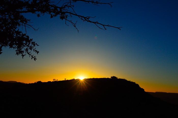
The mountainside is set ablaze by the first reach of the morning sun.
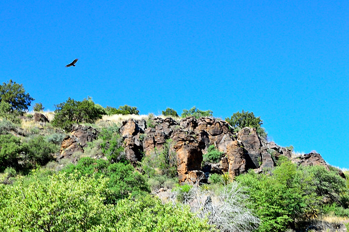
I slip and stumble up Montezuma Quail trail, the pale heat of the sun warms my cheek. Footing is treacherous and balance is critical (I should’ve brought my walking stick). Not only is the mountainside gravelly and steep, it’s peppered with sotol, cholla cactus and other nasties—fantasies of being cut to pieces as I roll helplessly down the mountain! From this vantage point, I peer at the surrounding volcanic cradle of cliffs and valleys, all keeping their animal secrets. The spread of mountains before me seems to be watching.
Of a sudden, I hear what sounds like the bleating of a lamb—and I search for the source. Nothing out there but a deep background of silence. I’m about halfway up the mountain with a large outcropping of granite near the top. I hear it again. As I locate the sound high among the rocks, I catch a glimpse of what appears to be a family of bighorn sheep. A ram, several ewes and two babies noiselessly skitter up the boulders and out of sight in an instant. I was later disappointed to learn they were Barberry sheep, an exotic species from northern Africa now thriving in these mountains. They probably considered me exotic.
For Central Texans, Davis Mountains State Park means a long trek through the Trans-Pecos ecoregion—an expressive lesson in “wide open spaces.” The park is located some 420 miles west of Austin.
People have lived in this area for at least 10,000 years.
Native Americans used the mountains and canyons as a sanctuary first. The lower end of Limpia Creek provided water for them year round. Up until about 1846, only a few white men had visited the area but that all changed after the war with Mexico. Prospectors, settlers and traders arrived on the scene. As settlements grew, so did conflicts with the Indians.
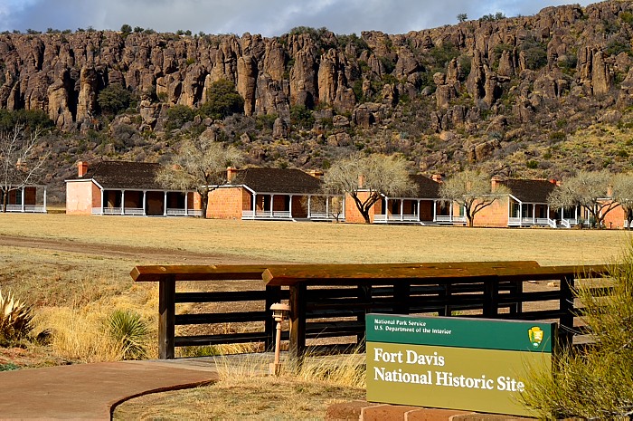
U.S. Secretary of War Jefferson Davis (who later served as president of the Confederacy) ordered the construction of the Fort Davis army post. The mountains carry his name, also. Fort Davis was active from 1854 until 1891, except for certain periods during the Civil War. The federal government declared the remains of the fort a National Historic Site in 1961. The National Park Service has since restored and preserved the fort.
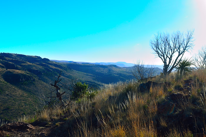
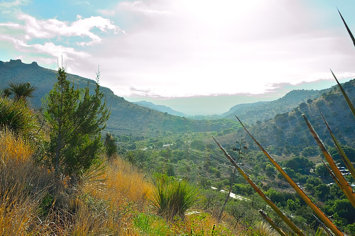
The state park, however, is located up the mountainside a short distance outside the town of Fort Davis. After checking in at park headquarters, the road cascades to the base of an immense canyon where most park amenities are located. These are not the picturesque, imposing snow-capped Rockies. These are the arid and rugged “Texas Alps.” Three distinct volcanic eruptions, 25-30 million years ago, resulted in the Frazier Canyon, Sleeping Lion and Barrel Springs formations, all of which help define the vista—a place of harsh towering beauty. Bisecting the park, Limpia Creek (and its tributary Keesey Creek) cut through the canyons, begetting numerous springs—lifelines for survival in the Texas high desert.
But the area is cloaked in contradictions.
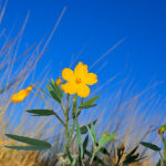
Located on the east slope of the Davis Mountain range, the park lies within the Chihuahuan Desert, the largest desert in North America. The Davis Mountains are one of just three “sky islands” in Texas supporting rare plants and species found nowhere else in Texas. Among these palisades, especially above 5,000 feet, it’s cooler and rains more than in other parts of the desert. Common pinyon pines, typically unable to live in west Texas desert habitats, are scattered in these higher elevations. Even with monsoon rains in the summertime, the plants cannot escape the dry desert heat at lower elevations—yucca, catclaw acacia, agarita—a tough, scrappy bunch. Herds of javelina and pronghorn antelope can be spotted in the lowland areas. Mule deer, bighorn sheep, mountain lions and Montezuma quail also find sanctuary here.
There is, within the park, an apartment where everyone goes to dream, a spiritual place.
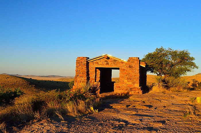
It perches atop the highest overlook at the end of Skyline Drive, a five-mile white-knuckle passage skirting up the mountain edge like crime scene tape. The CCC excavated the winding road by steam shovel in the 1930’s, tracing the nape of the mountain all the way up from the canyon floor. At the top, the boys of CCC companies 879, 881 and 1856 constructed a stone building offering stunning views. This building, bronzed by the setting sun, serves as a sanctum for dreams and contemplating eternity while the day slowly fades into a wash of stars.
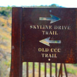 Nearby, hand-hewn stone picnic tables and fireplaces nestle under the protection of a few stunted trees. Colossal stone steps nearby drop down to a famous pedestrian intersection below: in one direction a 1.75 mile CCC trail connects to nearby historic Ft. Davis; in the opposite direction a 4.5 mile CCC hiking trail meanders back to the floor of the park. It’s a magical place folks—when you go, you must experience it at sunset.
Another iconic structure in the park is the fabled Indian Lodge, a 39-room hotel with white adobe walls, swimming pool and a restaurant. Opened in 1939, it resembles a multi-level pueblo village. Romantic and secluded, generations of children must have been conceived here! Nestled in the far west end of the park, it’s a destination in its  own right, usually with a waiting list. Old black & white movies (with free popcorn) are shown each Saturday night. For those who prefer more private pursuits, in the evening constellations sprawl above the rooftops in clockspring profusion—the McDonald Observatory keeps watch just 10 ½ miles up the mountain off State Highway 118.
Still, there’s plenty to do in this park. Hikers, photographers and horsemen can enjoy over 11 miles of trails through rugged wilderness scenery while redtails cruise the high thermals overhead. At the bottom of the canyon one can unwind in the shade while observing “The Best Little Bird Blind in Texas.” There, you can while away the hours beside a scintillating waterfall reminiscent of a Hamms beer sign, surrounded by an assortment of bird feeders with fresh orange and apple slices pinioned to nearby tree branches. It’s not just popular with birds in this desert environment—it’s an oasis that draws ground squirrels and other critters looking for refreshment.
 At this popular park, there is a modern interpretative center, bustling with activity. Miraculously, there is only one park interpreter but she is a master at leveraging the talents of others. The center offers varied programs and presentations, mainly through use of park hosts with special skills. During our stay the schedule included weekly star parties, area tourist attractions, the men of the CCC, desert wildlife and a unique recurring offering by the Ft. Davis Animal Shelter. The latter entails bringing five or six shelter dogs to the overlook atop Skyline Drive and recruiting willing park patrons to exercise the dogs. There is no problem finding volunteers. Not only does this provide much needed walks for the dogs but it also, according to the shelter attendant, helps find forever homes. What an enchanted place to meet your next BFF.
Davis Mountains State Park is ideally located as a base camp for enjoying the regional sites. Within easy driving distance is Marfa, Texas, home to the mysterious Marfa lights and a mecca for shopping and art. Environmental education awaits at places like Davis Mountain Preserve, Museum of the Big Bend in Alpine and the Chihuahuan Desert Nature Center. Already mentioned just up the road from the park is the renowned McDonald Observatory—this alone takes a full day or more to explore completely—and it’s guaranteed to capture the interest of even the most indifferent tourist. The Fort Davis National Historic Site, near the town of Fort Davis, preserves the remains of a functioning frontier cavalry post, circa late 1800s. Perhaps the most enjoyable afternoon is a leisurely drive around the nearby 75-mile Scenic Loop Drive—a collage of magnificent mountains and lowland grasslands, awash with wildlife and pastoral countryside. A quiet picnic along the roadside pullout below Sawtooth Mountain is, by itself, a forever memory.
Make no mistake. Davis Mountains State Park is a full-fledged vacation destination, worthy of the long drive. It’s a popular place. Get your reservations in early and stay at the Indian Lodge, or camp in the well-barbered campsites. It’s among the most active and creatively managed parks I’ve seen. At this higher elevation, the monsoon season, which occurs June through September, cools the air for a delicious escape from the blazing Texas summers. Mix your days in nature with interesting side trips outside the park and soak in the whiskey-colored sunsets and lilac dusks of the west Texas desert. Warning: if you’ve never been, once you drink the cool aid you won’t want to leave!