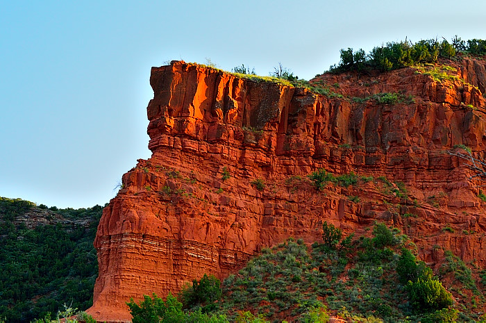
Miles and miles of endless horizon on the Texas panhandle, the prairie spreads away flat and featureless to nowhere. Then, suddenly, the landscape transforms into a menagerie of cliffs and monoliths and distant vistas, melted into warm earth tones under the steady smash of the sun. As they pick their way down the scree, leather saddles creak, stones and pebbles rain down ahead of them and thick dust rises up. Big, haunchy stallions with eyes like cue balls lash their tails back and forth during the nervous descent. Later, standing on the floor, they find themselves surrounded by unspeakable beauty—of stillness, peace. This is what I imagine it was like for the first explorers who discovered this magical place.
Except for the time warp and means of transport, this fairly describes my own first experience at the park! It’s a sense of astonishment—not expecting that kind of transformation—that makes Caprock Canyons State Park one of my favorites.
Millions of years of water and sediment flowing from the Rocky Mountains fashioned the Great Plains. Flanking each side of the Southern High Plains in New Mexico and Texas is the Caprock Escarpment. It divides the flat plains of the west from the rolling plains to the east and locates broad broken stretches of arroyos and canyons like Palo Duro. It’s within this rock face in Texas that the Colorado, Brazos and Red rivers are born. It’s also within this rock face that Caprock Canyons State Park was chosen in 1975.
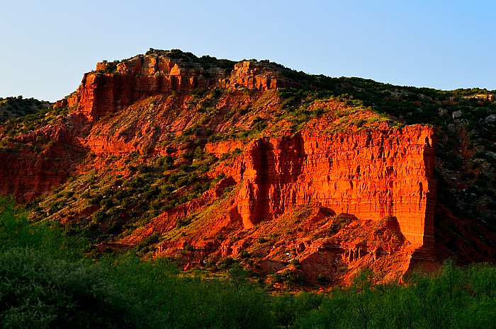
Upon entering the park, the long road eventually empties into a massive parking lot flanked by an oddly contemporary headquarters building. Here you can sign for a handy audio driving guide; a nifty way to learn the history and main features of the parklands. At the headquarters you can also can pay hiking fees for the Caprock Canyons Trailway (more on that later). Outside the headquarters is a grand overlook interpretation area, offering information boards with a sweeping view of the canyons and the splendor which defines them.
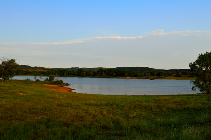
As you move into the main park, the first feature encountered is a shimmering 120-acre lake. It’s Lake Theo, named after an early owner of the land. Fishing is allowed, as is no-wake boating and swimming. The lake also attracts wildlife looking to refresh and re-hydrate. Trails can be found throughout the entire park. There are almost 90 miles of hiking trails, most of which are equally open to mountain biking. The active hiker can select from a variety of options from very easy (Mesa Trail, just over 1 mile) to very challenging (Haynes Ridge Overlook Trail-15 miles). My favorite: Eagle Point Trail—a very doable 2 mile trek from the canyon floor, up the canyon face, to the rolling hills surrounding Lake Theo.

If there ever was a state park where critters rule, this is it. This land, when the climate was cooler and damper 12,000 years ago, supported mammoths, giant bison, camels and horses. These days, we have smaller fare.
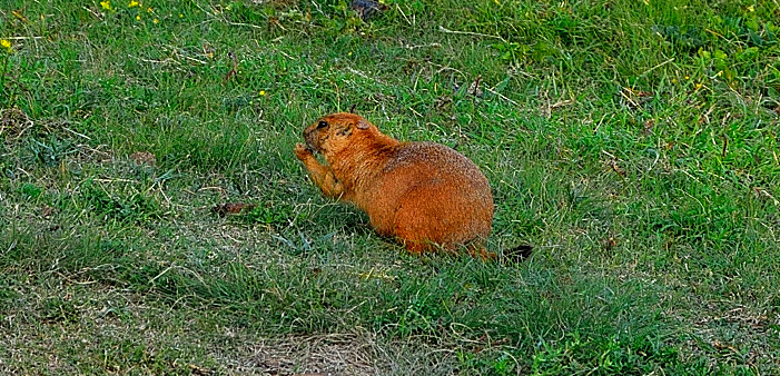
To wit: the sidewalk to the campground restroom area skirts a bustling community of prairie dogs. There are even warning signs along the road, as if it was a miniature school zone. This is one of the most entertaining “grapevines” you’ll ever witness, complete with sentries, scouts, messengers and an assortment of busybodies, all connected by endless underground tunnels. I couldn’t help feeling self-conscious walking by, knowing I was the subject of malicious and disparaging gossip behind my back . . . I could feel all those beady little eyes peering at me!
The most egregious realization I was not the dominant species happened when a detachment of hulking brown bison casually strolled through the campground, eyes black and brooding, like some street gang. Turns out, they are members of the Texas State Bison Herd. This is their official home; they’re entitled. Famed cattleman Charles Goodnight and his wife, Mary Ann, started the herd in 1878. It was one of the five foundation herds which saved this animal from extinction.
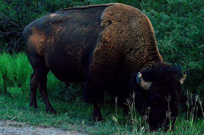
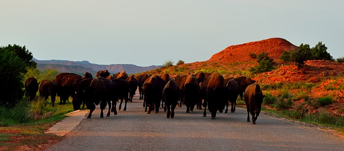
When Lake Theo calls the herd to pay a visit, don’t get in its way. One evening we decided to take a drive to enjoy the splendid sunset, only to meet such a pilgrimage point blank in a disputed right-of-way. No time to react, no place to go . . . we were quickly surrounded like a grain of rice in a spilled sack of coffee beans. The bison never blinked; we sat there slack-jawed in disbelief.
Other critters live here too, although it’s tough to find them during daylight hours. Pronghorn antelope can sometimes be spotted in the distance with field glasses. White-tailed and mule deer inhabit the junipers and scrub by day, then browse the tree line at dusk and dawn. Ranchers eradicated wolves and black bears in the 1950’s, leaving bobcats, raccoons, grey foxes and jackrabbits to run the range today. In the skies, red tail hawks rule with occasional interventions by a golden eagle or two. The real success story here, however, is reptiles: there are over 14 species of lizards and 30 species of snakes that call these canyons home . . . a school girl’s delight!
So how do you find this place? Set your navigation system, bring your tent or RV and plan to spend a few days. Located just south of Palo Duro Canyon, Caprock Canyons is 100 miles southeast of Amarillo, in Briscoe County, just over 475 miles from Bastrop. It’s not a day trip.
The park was officially opened to the public in 1982, after TPWD purchased the land in 1975. Today the park sprawls over 15,300 acres, including 1,217 acres of the Caprock Canyons Trailway. The trailway is an old abandoned Burlington Northern railroad line which significantly extends the hiking, biking and equestrian trail systems of the park.
This old rail route crosses 3 Texas counties and takes travelers over numerous railroad bridges, the most impressive of which spans more than 200 feet over the often-dry Los Lingos Creek. The trailway also runs through the 742-foot-long Clarity Tunnel—one of the last active railroad tunnels in the state. This tunnel has attracted a large community of Mexican free-tailed bats who now use it as a summer vacation home.
Access points to the trailway can be found in the park, at various road crossings and in nearby towns. Travelers use self-pay stations along various entry points (or pay at the headquarters building in advance). This old roadway is broken into smaller segments, anywhere from 5 to 12 miles long, offering travelers a chance to tailor their own adventure. Old trestles have solid decking and side rails for safety. There are some 46 bridges in total. Needless-to-say, users need to come prepared. No water is available on the trailway even though there are comfort stations located at various points along the way. These are serious hikes.
In fact, remote aptly describes this park. To get an acceptable Internet connection, plan on driving into the quaint little town of Quitaque (pronounced ‘Kitty-Quay,’ or ‘Kit-ta-Quay’) to visit the local library. Be sure to say ‘Hi’ to Faye, hear? This Texas town boasts a population of something over 400 souls who don’t bother to lock their car or house every time they go out. You might say life is simpler here and moves a little slowly compared to most other bergs. Not only does the community serve as the entrance to Caprock Canyons State Park but it’s also one of those entry points to the trailway already mentioned. Quitaque’s a town with character which has endured everything from enterprising Comancheros to raiding Indians over the years. I guarantee you will find it charming—and you can find groceries and other stuff needed to re-supply.
How this town got its name is somewhat in dispute. One story is that the name Quitaque was taken from the Quitaca Indians, whose name was translated by white settlers as ‘whatever one steals.’ A second explanation claims Charles Goodnight, who ranched nearby, first introduced the name. He thought it was an Indian word which meant “end of the trail.” Yet another suggestion holds that the name was derived from two buttes in the area that resembled piles of horse manure, the real meaning of the word.
All right, there you have it. Off the couch. Time to act. There’s a lot to see and do at Caprock Canyons: bison, bats, fishing, kayaking, hiking, camping, horseback riding, geocaching. . .and. . .unforgettable sights. Palo Duro is palatial and renowned. Caddo Lake is mysterious and secretive. But Caprock Canyons is exclusive; you won’t find any other state park in Texas quite like this. It will stir your soul. Get there before autumn thickens and the chill gets into her. Select a weekend, clear your calendar—and put out the ‘gone fishin’ sign!


