Did you ever celebrate Cinco de Mayo in Austin? May 5th each year honors Mexican people, history, culture and heritage. The event is also celebrated in Chicago, Los Angeles, Sacramento, San Francisco and other cities of Hispanic presence throughout the United States. The Texas state legislature proclaimed Goliad the official site for Cinco de Mayo in 1992. The hallowed grounds around Goliad State Park were soaked in blood on this day in 1862 when Mexican General Ignacio Zaragosa defeated the French at the battle of Puebla. His victory led to Mexico’s independence from France. Zaragosa was born near the Presidio La Bahia only eight years after Mexico won independence from Spain. That presidio, and Zaragosa’s reconstructed birthplace and home, are now located next to one another near the front gate of the park. You can also visit a statue of Zaragosa donated by the citizens of Puebla, Mexico.
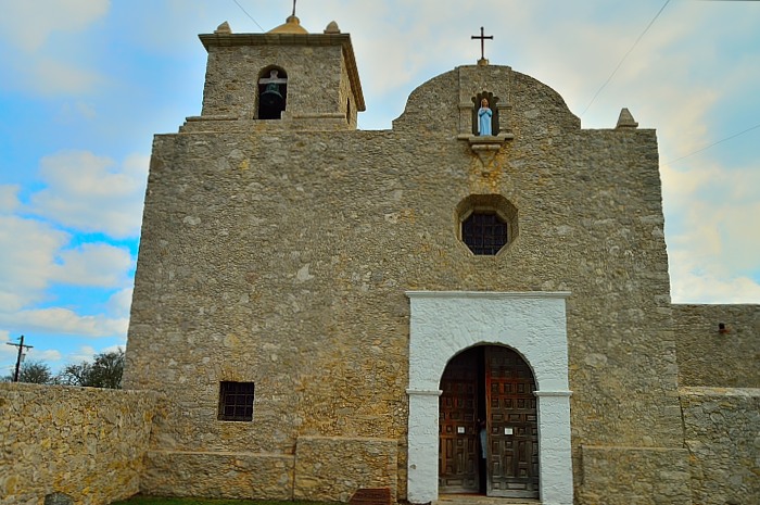
Presidio La Bahia was originally built in Matagorda Bay but was moved to Goliad in 1749. Through the ensuing years, the presidio would witness no less than nine different national flags fly over its ramparts. While the site of a famous victory for Mexico, it would later become—by Santa Anna’s execution of 350 Texan prisoners of war there—a motivating force in Texas’ war of independence. A monument to Colonel Fannin and his condemned men is found nearby the presidio. The rallying cry, “remember Goliad” would rise up next to “remember the Alamo” as Texas troops forced a final change of flags (the Texas flag) over the venerable old fort.
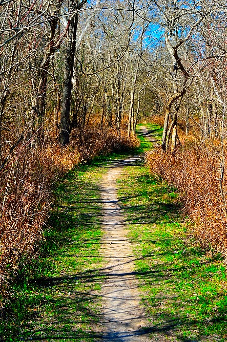
A diminutive 276 acres, Goliad State Park is a protected historical keepsake. Still, it nestles campers behind thick walls of Texas brush land, offers hiking loops on the Great Texas Birding Trail, fishing on the San Antonio River, mountain biking, over 6 miles of kayaking on the Goliad Paddling Trail, and provides group overnight sites. The trail system is varied and hiker friendly. You can stroll down the pensive gallery woodlands along the San Antonio River, take a short nature hike on the Aranama Trail near the old mission, walk to each of the nearby historical sites or even trek down the 2 ½ mile route into the city of Goliad itself, where you can enjoy a walking tour of Courthouse Square and the nearby historic district of the town.
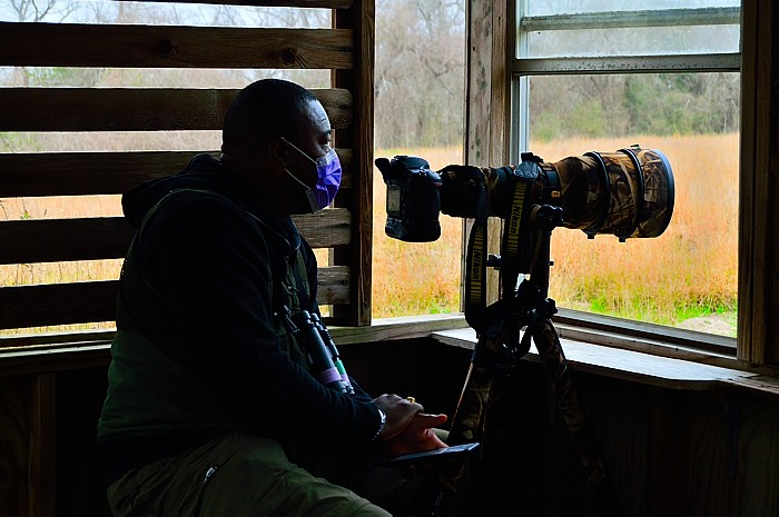
During my visit, one of the most popular areas of the park was Cardinal’s Haven Bird Blind. Located on the forest edge, just off the paved road is a luxurious well-tended bird refectory. Multiple feeders, suet displays, peanut butter stalls, flowing water and fresh fruit abound—virtually ensuring a steady scrum of bird activity. The blind itself is relatively small, allowing only a few observers at a time, but the line of sight is short, wide, and the birds are so voracious they are oblivious to being watched. I met one gentleman whose only purpose in coming to the park was to photograph birds at this particular blind.
The park is just a few miles outside the city of Goliad, in Goliad County, and sits astride the famous El Camino Real (King’s Highway). To be there is like stepping back in time to when Spain ruled the land. Mission Espiritu Santo sprawls on your right, a period specific visitor’s center on your left, the La Bahia Presidio, Fannin Memorial Monument, and the Zaragosa Historical Site are all within walking distance. Yet, the park entrance itself is easy to miss because most of the attractions are outside the boundaries of the park. It’s easy to be taken in by the architecture, and before you know it, you’ve missed the entrance.
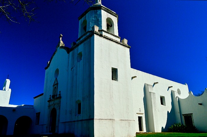
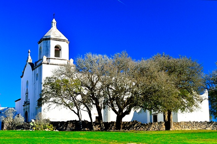
In 1931, the City of Goliad offered up Mission Espiritu Santos to the State of Texas, who, in 1949 transferred it to the State Parks Board. Other sites became part of the complex in later years. CCC company 3822 (comprised of all war veterans) was sent in between 1935 and 1941 to do basic park construction projects (picnic tables, culverts, decorative metalwork) and major reconstruction and restoration of the 18th century mission building. Today it’s the only historic building located inside the park. Oh, but what a magnificent building it is!
Like the presidio down the road, the mission was established by the Spaniards near Matagorda Bay to serve the Karankawa Indians. The Indians abandoned the mission in 1724, and it was moved to a site near Victoria, in the territory of the Aranama and Tamique Indians. Finally, in 1749, it was moved a last time, to a hill lying in a large loop of the San Antonio River just south of the present-day town of Goliad.
The mission lasted 108 years—longer than any other Spanish mission in Texas. Sporadic rains made farming difficult at the mission but ranching thrived. With over 40,000 head of livestock at its peak, the mission ran the first large cattle ranch in Texas. Indian raids decimated the herd and, finally, in 1830 the mission became secularized. The mission property was divvied up among colonists, and the buildings were used as schools for a number of years. Already closed and in severe disrepair, the final stroke was a devastating hurricane in 1886. The ruins were looted and cannibalized for lumber and stone, leaving little of the original mission by the time the site was designated a historical park by the state legislature in 1931. The CCC then excavated and reconstructed the mission, although it probably differs somewhat from the original structure.
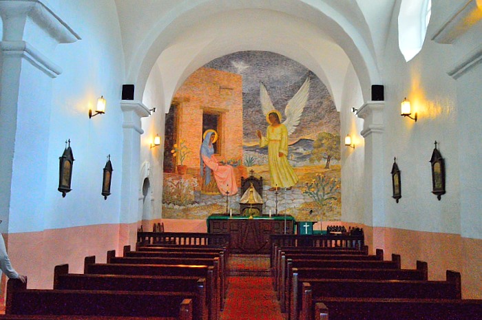
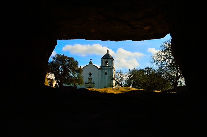
Today, in the grim grey light of dawn this beautiful old mission bestows a quiet aura of reverence over all who walk its grounds or admire its lavish interior. It is available for wedding bookings and other commemorations. At Christmas time, the outside grounds delight passersby with a brightly lit necklace of bordering Candelária. An old stone wall, imposing but not impregnable, encircles the mission—a reminder that life was uncertain during its active lifetime.
The mission’s neighboring protector—the Presidio La Bahia—evokes equally contemplative respect, not only for what it meant to area residents but also for the acts of cruelty and mass extinction that occurred there.
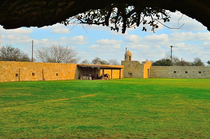
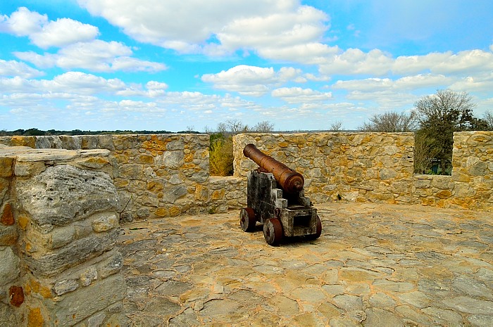
Standing at the center of the parade ground you can feel the protection of limestone walls or imagine the booming cannon fire from its parapets. Everything needed to survive for an extended period could be found inside these protective walls. The fort was a small universe unto itself.
The last historic relic is open to visitors by appointment only. The ruins of the 1750’s Mission Nuestra Senora del Rosario are about a 4-mile drive from the park, just west of the town of Goliad. There’s not much left of this old mission anymore (it was not as successful as Mission Espiritu Santo) but a historical marker and interpretative signs explain its history.
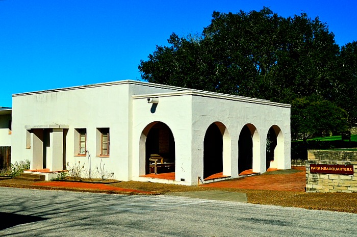
In the midst of all this history, be sure and stop by the visitor’s center (officially, El Camino Real de los Tejas Visitor Center). It is NOT located within park grounds (1/2 mile north of the park), but rather along the highway for which it is named. The park custodian’s cottage is a prime specimen of Spanish architecture (built by the CCC) while the center itself tells the story of the King’s Highway, which carried goods, travelers and settlers from Mexico City north to what would one day become the states of Texas and Louisiana. You can have the park “your way.” All the buildings and monuments (except Mission Rosario)—including historic downtown Goliad—are interconnected by walking/biking trails. Or, if you prefer, ranger-led historical tours are offered every weekend at 2:00 pm (nature hikes at 10:00 am). These tours can also be arranged upon request.
As beautiful and historical as this park is, there is a dark side. It represents as much failure as it does success. Good intentions, when filtered through the foggy lens of religion, can sometimes destroy people rather than lift them up. While this Spanish mission was unquestionably a source of sustenance and protection it also was a monument to eradication of “savage” beliefs and redemption of souls. Mission life, in fact, proved to be the downfall for native traditional life. Affected in particular were the Tamique and Aranama Indians. When situated in Matagorda, this mission contributed to the total eradication of Karankawa tribal values. In return for food, shelter and protection from more aggressive tribes, these Indians agreed to live and work in the mission, follow its discipline while receiving instruction in the Roman Catholic faith. In the end it was a gradual erosion and eventual destruction of traditional tribal ethos. Unfortunately, the desire to force certain western religions on foreign cultures remains a scourge on the world today. As with all things in life, the path to the truth lies in the middle. Those who claim there is only one way are blind to the truth themselves.
By Larry Gfeller