


Following the Water Road: Paddling Pine Island Bayou
A first visit to Big Thicket National Preserve, a ranger-led canoe trip, and a reminder that Southeast Texas waterways were once the roads of daily life.

On a rainy Saturday morning, Cynthia and I joined a National Park Service paddle program on Pine Island Bayou in Big Thicket National Preserve. It was Cynthia’s first visit to the Big Thicket, and the bayou offered the right introduction: dark water, cypress-lined banks, quiet bends, and a sense that the modern world had faded behind the trees.
At first glance, Pine Island Bayou looks like a place set apart for wildlife, paddling, and reflection. Today, that is largely how many of us experience it. We come to observe birds, study plants, photograph reflections, or learn how a blackwater stream moves through a floodplain forest. But for earlier generations in Southeast Texas, a bayou like this was not simply scenery. It was infrastructure.
Meeting the Bayou from the Water
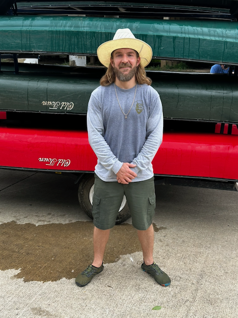
Our trip was led by Park Ranger Max Harper, Paddle Program Coordinator for Big Thicket National Preserve. Ranger-led paddles are a practical way to experience the preserve from the water, especially for visitors who may not know the local access points, water conditions, or natural history of the area.
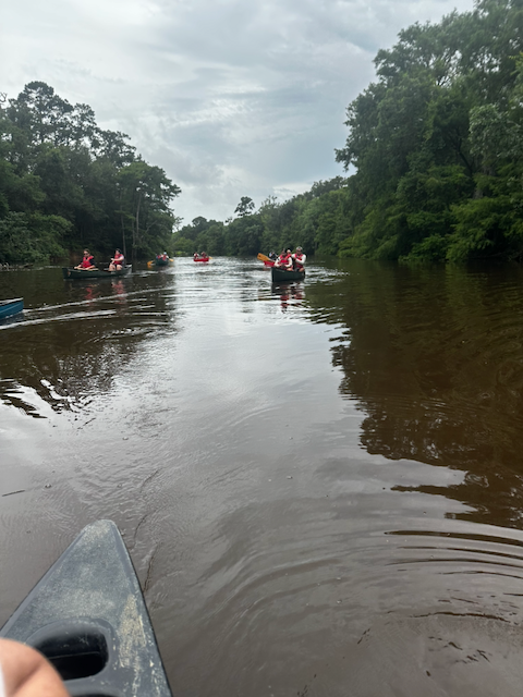
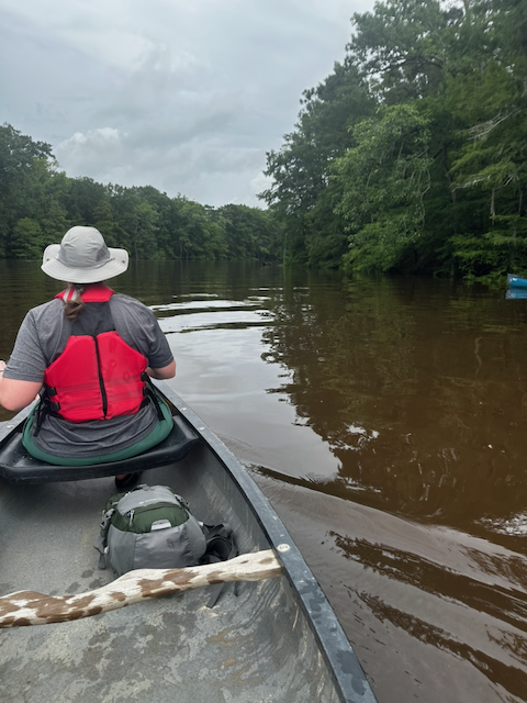
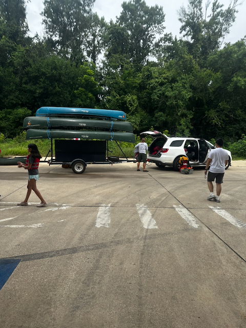
Before launching, the group gathered near the canoes, adjusted life jackets, and listened to instructions. A paddle trip begins with simple things: where to sit, how to balance the canoe, how to turn, how to keep spacing between boats, and how to pay attention to weather and water. Those ordinary preparations mattered more under the heavy gray sky, where the air felt humid and the bayou looked both calm and powerful.

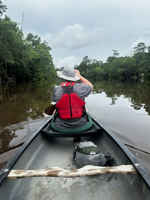
Once underway, the perspective changed immediately. From a road or overlook, a bayou can appear as a line on a map or a dark strip of water between trees. From inside a canoe, it becomes a corridor. The banks rise and fall. Roots hold the soil in some places and surrender it in others. Fallen limbs become perches, habitat, and obstacles. Every bend limits the view ahead, making the next turn part of the experience.
For Cynthia, this was a first encounter with the Big Thicket from the inside rather than from a roadside or trailhead. That matters. The preserve is not one single landscape, but a collection of waterways, forests, bogs, baygalls, uplands, and floodplains. Pine Island Bayou introduces the Thicket by water, and water has always been one of the best ways to understand this region.
The Bayou as Highway
Today we often describe Pine Island Bayou in ecological terms, but its human history is just as important. The Texas State Historical Association notes that many of the earliest recorded settlers in Hardin and Jefferson counties settled along the bayou, and that nineteenth-century steamboats navigated its lower waters while trading with residents of the region.
That statement changes how a paddler sees the landscape. The quiet water beneath a canoe was once part of a working transportation network. Before reliable roads, bridges, railroads, and highways, waterways such as the Neches River, Village Creek, Pine Island Bayou, and their tributaries linked scattered settlements to each other and to larger markets.
Roads through the Big Thicket were difficult. Heavy rainfall, low ground, dense vegetation, and floodplain soils made overland travel slow and seasonal. A wagon could bog down in mud. A trail could disappear beneath water. A bayou, by contrast, could carry people, mail, tools, lumber, farm products, and trade goods when conditions allowed. The water was not an obstacle to movement. It was the route.
Historical references to steamboats on Pine Island Bayou can be brief, but they are revealing. They remind us that the bayou was not isolated from commerce. It connected to the Neches River system, and the Neches connected inland communities to Beaumont and the Gulf Coast. In that sense, Pine Island Bayou was not the edge of the world for nineteenth-century residents. It was part of their connection to it.
That is the idea many modern visitors miss. We tend to think in terms of highways, county roads, driveways, and parking lots. Earlier residents thought in terms of landings, river bends, crossings, ferries, flood stages, and navigable channels. Water shaped where people settled, how they traded, when they traveled, and how they understood distance.
The Character of Blackwater
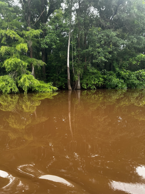
The water in Pine Island Bayou was dark brown, almost tea-colored in some places. Visitors sometimes describe this as muddy water, but blackwater streams are often stained by tannins and dissolved organic material from leaves, wood, roots, and floodplain soils. The color is part of the system’s character.
Along the banks, bald cypress, hardwoods, vines, shrubs, and understory plants crowded the waterline. Some trees stood with roots exposed by erosion. Others appeared to rise directly from the flooded edge. Reflections of trunks and clouds stretched across the surface, broken only by paddle strokes and the wake of passing canoes.
Big Thicket National Preserve protects a landscape where plant communities overlap in unusual ways. Pine Island Bayou and nearby waterways help support bottomland hardwood forests, cypress-tupelo swamps, baygalls, and wetland edges. These habitats are dynamic. Water rises and falls. Banks erode and rebuild. Logs fall, decay, and become part of the food web.
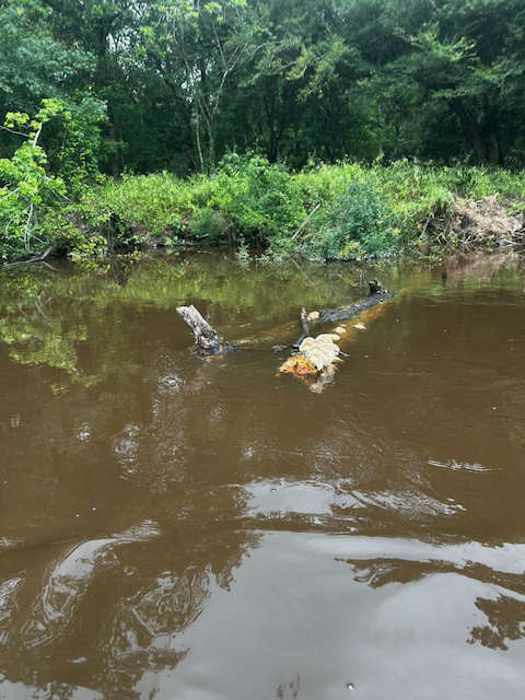
One fallen log along our route carried pale shelf fungi above the waterline. It was a small detail, but it told a larger story. Decomposition is not waste in a floodplain forest. It is process. Fungi, insects, bacteria, and water slowly return wood to the system, feeding the next generation of growth.
A First Visit to the Big Thicket
Because this was Cynthia’s first time in the Big Thicket, the trip became more than an outing. It became an introduction. Trails can show the preserve one step at a time, but a canoe shows how the landscape is stitched together by water. The bayou carries the eye forward. It asks the visitor to slow down and notice what is close: a root system, a leaning cypress, a ripple against the hull, the sound of paddles entering the water.
The day was overcast, and at times the sky seemed heavy enough to touch the treetops. That weather suited the bayou. Bright sun can flatten a landscape, but soft gray light deepened the greens of the forest and sharpened the reflections in the water.

In several places, there were few visible signs of modern development. That absence made the historical imagination easier. It was not difficult to picture a small steamboat working its way through the lower bayou when water levels permitted, or to imagine people waiting at a landing for goods, news, or transport.
Of course, the bayou was never untouched. Indigenous peoples, settlers, traders, farmers, timber interests, and later conservationists all shaped the history of this watershed. But from a canoe, the continuity of the place is still noticeable. The same dark water that carried commerce now carries paddlers. The same floodplain that complicated road building still slows travel and rewards patience.
Why This Water Road Still Matters
The National Park Service describes Big Thicket National Preserve as a place with many paddling opportunities on rivers, creeks, bayous, oxbow lakes, and cypress sloughs. That variety is not just recreational. It is central to understanding Southeast Texas.
Waterways shaped settlement patterns, commerce, plant communities, wildlife movement, and the daily decisions of people who lived here before paved roads became dependable. To understand Pine Island Bayou only as a scenic paddle is to miss half the story. To understand it only as a historic route is to miss the living system still at work along its banks.
For Master Naturalists, that combination is important. We study nature, but we also interpret place. A place is more than its species list. It includes memory, use, change, and the ways people have understood the land and water over time. Pine Island Bayou gives us all of that in one slow-moving channel.
Visitor Notes
- Big Thicket National Preserve offers ranger-led paddle programs and information about paddling routes, boat launches, and safety.
- Conditions on Southeast Texas waterways can change quickly. Check weather and water levels before paddling.
- Wear a properly fitted life jacket and follow National Park Service guidance for safe paddling.
- Respect public and private boundaries along waterways. The preserve notes that private property may exist along some corridors.
Photo Notes from the Trip

Looking Back from the Canoe
By the end of the trip, Pine Island Bayou felt less like a destination and more like a passage through time. We had paddled through a living ecosystem, but also through a historic corridor. The trees, water, fungi, roots, and reflections were present-day observations. The steamboats, landings, settlers, and trade routes belonged to another century. The bayou held both stories at once.
That may be the lesson worth carrying forward. In Southeast Texas, water was not just scenery. It was movement, connection, commerce, food, work, and daily life. Pine Island Bayou still teaches that lesson, but it teaches slowly. You have to get close to the water, listen to the paddle strokes, and imagine the road that flowed beneath you.
Sources and Further Reading